
GeoDistance_demo
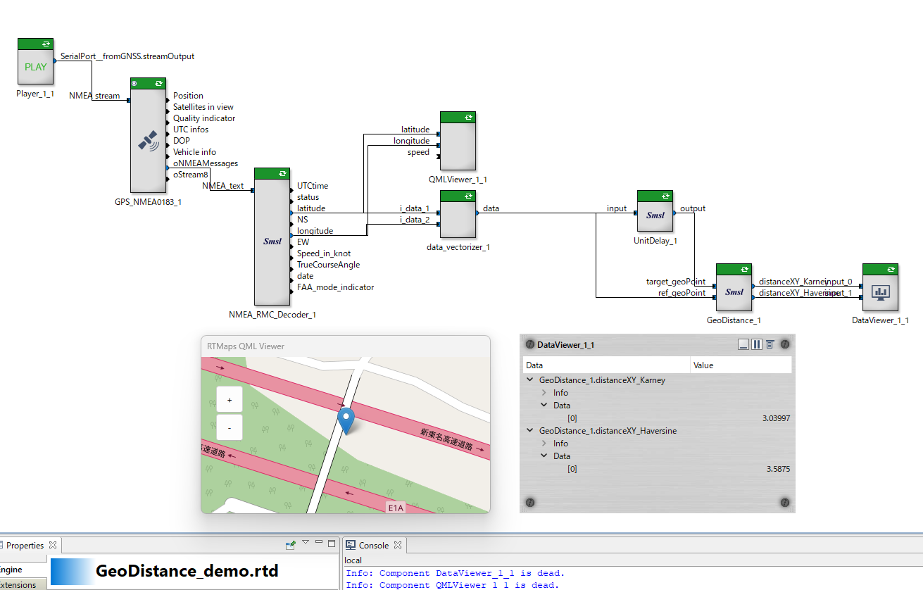
GeoDistance_demo.rtd is an example to calculate the distance between 2 Geographic points with latitude and longitude.
The Geographic points in the input signal moves. The diagram calculate the moving distance by steps with the UnitDelay.
Unfortunately the input signal is not provided by SMSL so far, you need to use any data from GNSS.